Construction Progress Documentation
Stay on top of every stage of your build with professional, time-stamped visuals. From behind-the-walls 360° tours to aerial progress mapping, Carolina Capture helps builders, developers, and owners clearly track progress and protect their investment.
360° Walkthroughs
Our immersive 360° tours capture every stage of construction:
Pre-Drywall & Insulation – Create a permanent visual record of plumbing, electrical, and mechanical systems before they’re covered.
Finished Home – Showcase the completed build in a stunning, interactive tour that builders and developers can share with clients, investors, or future buyers.
With secure, password protected and time-stamped tours, you’ll always have proof of what’s behind the walls and a powerful marketing tool to highlight the quality of your work.
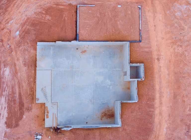
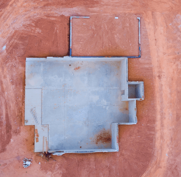
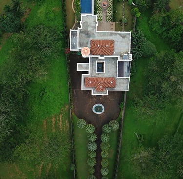
Exterior Progress Photos
Show your project’s progress at every stage with consistent exterior imagery. Using drones, we capture high-resolution aerial and low-altitude photos at key milestones — foundation, framing, roofing, and completion. These visuals create a clear timeline of your build that can be shared with owners, investors, or clients, offering both accountability and a powerful way to showcase your work.
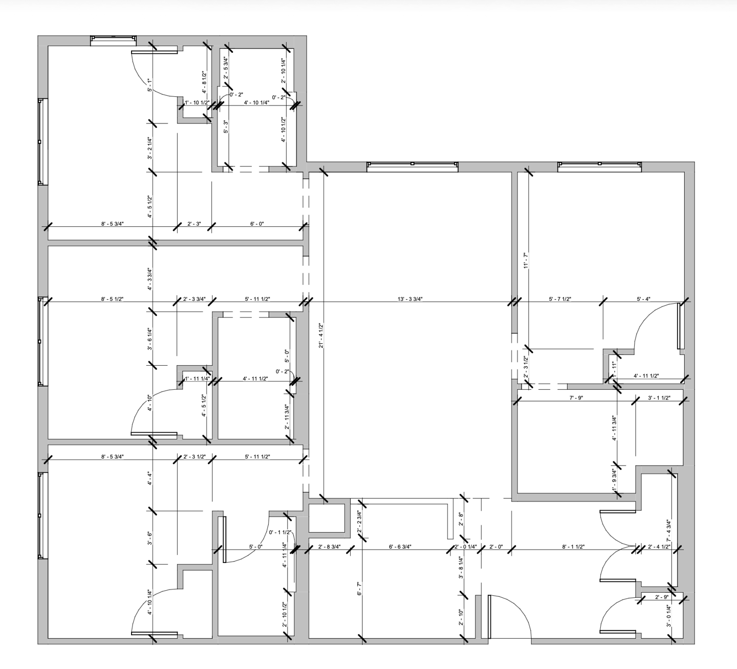
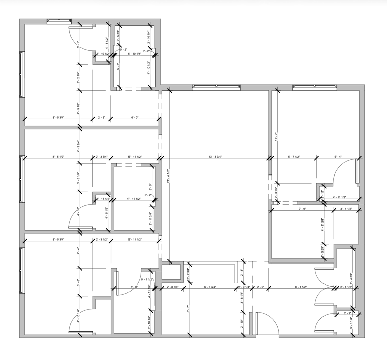
As-Built Documentation
Capture the finished project with accuracy and detail. We provide a professional 360° virtual tour of the completed build along with as-built drawings that record any changes made during construction. This combination creates a permanent, visual record for owners and builders while also serving as a powerful marketing tool to showcase the finished work.
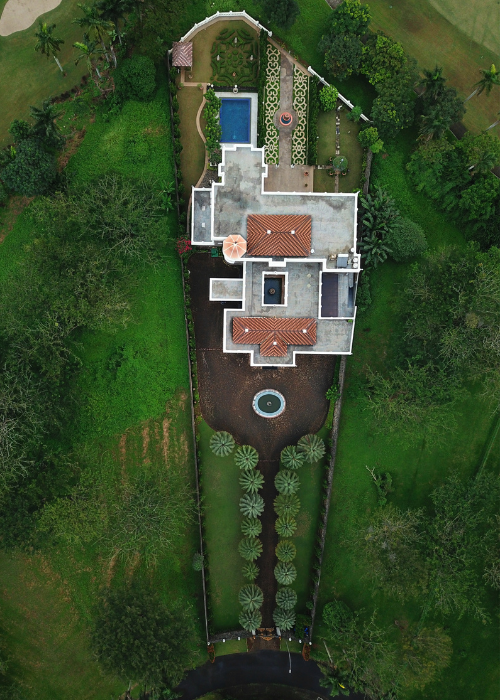
Gain a complete, measurable view of your job site with high-resolution aerial maps. Using advanced drone technology, we create time-stamped, georeferenced images that provide a reliable record of progress at every stage of construction. These maps allow builders to verify grading, foundation placement, and infrastructure work with confidence, while also making it easy to track large developments across multiple buildings. Owners and investors benefit from clear, shareable updates, and contractors gain a permanent visual record that can be referenced for warranties, inspections, or future development. Whether it’s a single lot or a large multi-phase site, aerial site mapping delivers clarity and accountability from start to finish.
Aerial Site Maps
Contact Us
drew@carolinacapture.com
(336) 908-1954